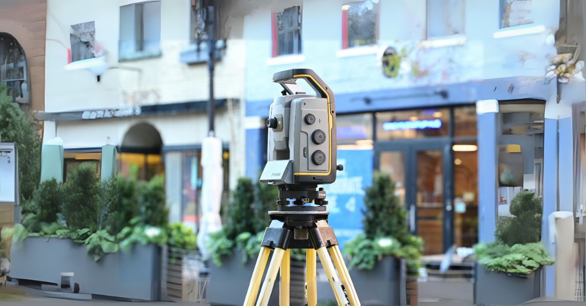
Level 2 Advanced Surveying and Mapping Techniques
Course Overview:
The Level 2: Advanced Surveying and Mapping Techniques course is designed to equip learners with comprehensive knowledge and practical skills in modern surveying and mapping methodologies. This course delves into advanced tools, technologies, and practices used in land measurement, data collection, and geographic analysis, ensuring participants are prepared to tackle complex projects in civil engineering, construction, and infrastructure development.
Benefits
- Enhanced Skillset: Master advanced surveying techniques and geospatial tools.
- Career Advancement: Position yourself for specialized roles in surveying and geospatial analysis.
- Hands-On Training: Gain experience with the latest equipment and software used in the field.
- Accuracy and Precision: Learn to deliver high-quality results in surveying and mapping tasks.
- Industry Recognition: Earn a certification valued by employers in civil engineering and construction.
Learning Outcomes
By the end of this course, participants will:
- Understand the principles of advanced surveying and mapping techniques.
- Operate modern surveying instruments, including GPS, total stations, and drones.
- Conduct precise land measurements and produce accurate maps.
- Analyze and interpret geospatial data for engineering and planning projects.
- Apply surveying practices to diverse applications like urban planning, construction, and resource management.
Study Units
- Foundations of Surveying and Mapping:
- Overview of surveying principles and history.
- Importance of mapping in civil engineering and urban planning.
- Advanced Surveying Equipment:
- Introduction to GPS, total stations, and laser scanning tools.
- Drone-based surveying and its applications.
- Techniques in Land Measurement:
- Horizontal and vertical control networks.
- Triangulation, traversing, and leveling methods.
- Geospatial Data Management:
- Data collection, storage, and processing techniques.
- Geographic Information System (GIS) integration for mapping.
- Mapping and Visualization:
- Creating detailed maps and 3D models.
- Applications of cartography in modern projects.
- Surveying Applications in Projects:
- Role of surveying in construction, infrastructure, and resource management.
- Case studies highlighting practical applications.
- Ethics and Standards in Surveying:
- Adhering to industry standards and ethical practices.
- Ensuring accuracy and integrity in survey data.
Course Outline
- Introduction to Advanced Surveying:
- Evolution of surveying techniques and their importance.
- Key concepts and terminology.
- Instrumentation and Technology:
- Hands-on training with GPS, drones, and other advanced tools.
- Techniques for calibration and maintenance of equipment.
- Geospatial Data Analysis:
- Data collection techniques using field instruments.
- Processing and analyzing data using GIS software.
- Mapping and Cartography:
- Steps for creating accurate and visually appealing maps.
- 3D visualization techniques and tools.
- Surveying Applications in Engineering:
- Role of advanced surveying in civil engineering projects.
- Techniques for topographical, hydrographical, and construction surveying.
- Practical Exercises and Case Studies:
- Real-world scenarios to apply surveying and mapping techniques.
- Group projects for collaborative learning.
Career Progression
Completing the Level 2: Advanced Surveying and Mapping Techniques course opens up exciting career paths:
- Surveying Specialist Roles: Positions like Surveying Technician, GIS Analyst, or Mapping Specialist.
- Infrastructure Development Projects: Opportunities in construction, roadworks, and urban planning.
- Advanced Certifications: Progress to Level 3 or specialized courses in geospatial technologies or infrastructure surveying.
- Consultancy and Freelancing: Establish a niche as a surveyor or mapping consultant.
- Global Opportunities: Work on international projects requiring advanced surveying expertise.
Why Choose Us?
- Industry-Leading Experts: Learn from seasoned professionals with extensive field experience.
- State-of-the-Art Tools: Access the latest surveying instruments and software.
- Globally Recognized Certification: Boost your career with a trusted qualification.
- Practical Learning: Engage in hands-on training with real-world scenarios.
- Dedicated Support: Benefit from personalized guidance and post-course assistance.
Step into the future of surveying and mapping!
Enroll in the Level 2: Advanced Surveying and Mapping Techniques course today and gain the skills to excel in a competitive and evolving field.
Our assessment process is designed to ensure every learner achieves the required level of knowledge, skills, and understanding outlined in each course unit.
Purpose of Assessment
Assessment helps measure how well a learner has met the learning outcomes. It ensures consistency, quality, and fairness across all learners.
What Learners Need to Do
Learners must provide clear evidence that shows they have met all the learning outcomes and assessment criteria for each unit. This evidence can take different forms depending on the course and type of learning.
Types of Acceptable Evidence
Assignments, reports, or projects
Worksheets or written tasks
Portfolios of practical work
Answers to oral or written questions
Test or exam papers
Understanding the Structure
Learning outcomes explain what learners should know, understand, or be able to do.
Assessment criteria set the standard learners must meet to achieve each learning outcome.
Assessment Guidelines
All assessment must be authentic, current, and relevant to the unit.
Evidence must match each assessment criterion clearly.
Plagiarism or copied work is not accepted.
All learners must complete assessments within the given timelines.
Where applicable, assessments may be reviewed or verified by internal or external quality assurers.
Full learning outcomes and assessment criteria for each qualification are available from page 8 of the course handbook.
Top Courses
No results found.
Related Courses
Let's Get in touch
Deleting Course Review
Course Access
This course is password protected. To access it please enter your password below:


